- Sanderstead
-
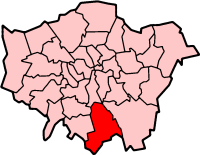
London Borough of Croydon 
Lage in Greater LondonStatus London Borough Region Greater London Verwaltungssitz Croydon Fläche 86,52 km² (256.) Einwohner (2007) 339.500 (9.) ONS-Code 00AH Website www.croydon.gov.uk London Borough of Croydon [kɹɔɪdn] ist ein Stadtbezirk im Süden von London. Er ist der bevölkerungsreichste aller Stadtbezirke und wuchs in den letzten Jahren zu einem bedeutenden Geschäftszentrum heran. Croydon gehörte bis 1889 zur Grafschaft Surrey, wurde dann eine kreisfreie Stadt und kam 1965 zusammen mit der Gemeinde Coulsdon and Purley schließlich zu Greater London. Die Bevölkerung setzt sich zusammen aus 70,2 % Weißen, 11,3 % Südasiaten, 13,3 % Schwarzen und 2,1 % Chinesen.
Croydon übernahm in mancher Hinsicht eine Vorreiterrolle in der Entwicklung des Verkehrswesens von London. 1803 wurde die Surrey Iron Railway nach Wandsworth eröffnet, die erste (von Pferden gezogene) öffentliche Eisenbahnlinie der Welt. Von 1920 bis 1959 lag bei Croydon der Hauptflughafen, welcher dann durch Heathrow und Gatwick ersetzt wurde. 2000 wurde das Straßenbahnsystem Croydon Tramlink eröffnet, 48 Jahre nach der Schließung der letzten Straßenbahnlinie Londons.
Stadtteile
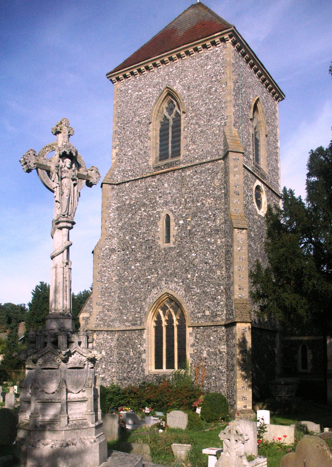
 St. Mary's Church, Addington
- Addington
- Addiscombe
- Broad Green
- Coombe
- Coulsdon
- Croydon
- Forestdale
- Hamsey Green
- South Croydon
- South Norwood
- Thornton Heath
- Upper Norwood
- Waddon
- West Croydon
- Woodcote
- Woodside
Persönlichkeiten
Die folgenden Persönlichkeiten sind in der einen oder anderen Weise mit Croydon verbunden. Der hohe Anteil an Musikern und Schauspielern erklärt sich dadurch, dass die BRIT School for Performing Arts & Technology in Croydon liegt.
- Peggy Ashcroft - Schauspielerin
- Lionel Atwill - Schauspieler
- Herbert Beer - Politiker
- Derren Brown - Illusionist
- Peter Brunt - Historiker
- Anne Clark - Musikerin
- Ian Cox - trinidadischer Fußballspieler
- Peter Cushing - Schauspieler
- Mickey Finn - Musiker
- Matthew Fisher - Musiker
- Jessie Gilbert - Schachmeisterin
- Trevor Goddard - Schauspieler
- Roy Hodgson - Fußballtrainer
- Les Humphries - Pop-Musiker
- David Lean - Filmregisseur
- M - Sänger
- Katie Melua - Sängerin
- Kate Moss - Supermodel
- Dickie Pride - Musiker
- John Ruskin - Schriftsteller und Sozialreformer
- Edward Woodward - Schauspieler
Weblinks
- Croydon Borough Council (Bezirksverwaltung)
Stadtbezirke von LondonBarking and Dagenham | Barnet | Bexley | Brent | Bromley | Camden | City of London | City of Westminster | Croydon | Ealing | Enfield | Greenwich | Hackney | Hammersmith and Fulham | Haringey | Harrow | Havering | Hillingdon | Hounslow | Islington | Kensington and Chelsea | Kingston | Lambeth | Lewisham | Merton | Newham | Redbridge | Richmond | Southwark | Sutton | Tower Hamlets | Waltham Forest | Wandsworth
Sonstige Einteilung: Greater London | Inner London | Outer London | County of London
Wikimedia Foundation.