Sabi Forest Park

Sabi Forest Park
Sabi Forest Park
Sabi Forest Park (Gambia)
Paris plan pointer b jms.svg
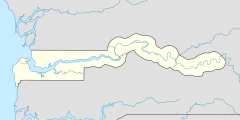
Lage: Upper River, Gambia
Nächste Stadt: Basse Santa Su
Fläche: 73 ha
Gründung: 1. Januar 1954
Besucher: öffentlich zugänglich
13.273055555556-14.200555555556

i3i6

Der Sabi Forest Park (Schreibvariante: Sabbi Forest Park) ist ein Waldgebiet im westafrikanischen Staat Gambia.

Topographie

Das 73 Hektar große Waldgebiet liegt in der Upper River Region (URR) im Distrikt Fulladu East und wurde wie die anderen Forest Parks in Gambia zum 1. Januar 1954 eingerichtet. Es liegt rund fünf Kilometer südlich von Basse Santa Su, dem Sitz der Verwaltungseinheit URR, und liegt östlich der Straße, die nach nächsten größeren Stadt Vélingara in Senegal führt. Vier Kilometer weiter auf der Straße, an der Grenze, liegt der Ort Sabi der dem Forest Park seinen Namen gegeben hatte.[1]

Siehe auch

Einzelnachweise

  1. Cartes ITM: Gambia Map, Estate Publications, 2003, ISBN 155341217-6

Wikimedia Foundation.

Игры ⚽ Поможем написать реферат

Schlagen Sie auch in anderen Wörterbüchern nach:

  • Sabi Forest Park — Infobox protected area | name = Sabi Forest Park iucn category = IV caption = locator x = locator y = location = Upper River Division flag|Gambia nearest city = Basse Santa Su long degrees = long minutes = long seconds = long direction = lat… …   Wikipedia

  • Dobo Forest Park — IUCN Category IV (Habitat/Species Management Area) Location North Bank Division &# …   Wikipedia

  • Marike Forest Park — IUCN Category IV (Habitat/Species Management Area) Location North Bank Division …   Wikipedia

  • Ngeyen Forest Park — IUCN Category IV (Habitat/Species Management Area) Location  Gambia …   Wikipedia

  • Ngongonding Forest Park — IUCN Category IV (Habitat/Species Management Area) Location  Gambia …   Wikipedia

  • Njama Forest Park — IUCN Category IV (Habitat/Species Management Area) Location  Gambia …   Wikipedia

  • Njau Forest Park — IUCN Category IV (Habitat/Species Management Area) Location  Gambia …   Wikipedia

  • Sabi — 13.234722222222 14.194444444444{{{elevation save}}}Koordinaten: 13°  …   Deutsch Wikipedia

  • Mamato Konko Forest Park — IUCN Category IV (Habitat/Species Management Area) Location  Gambia …   Wikipedia

  • Niumi National Park — IUCN Category II (National Park) …   Wikipedia

Share the article and excerpts

Direct link
Do a right-click on the link above
and select “Copy Link”