- Rice County (Minnesota)
-
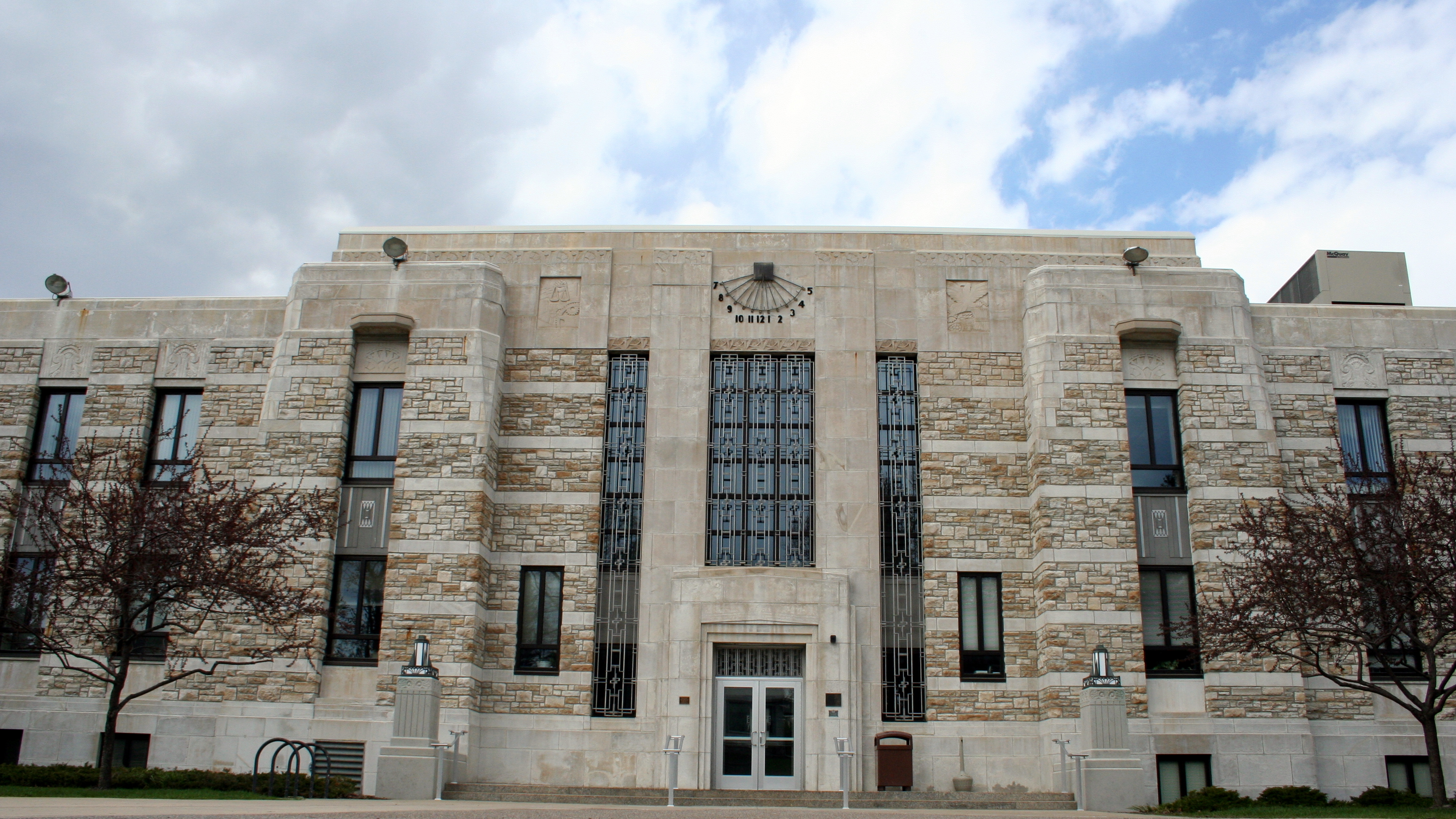
Verwaltung US-Bundesstaat: Minnesota Verwaltungssitz: Faribault Adresse des
Verwaltungssitzes:County Government Services Building
320 NW Third Street
Faribault, MN 55021-5195Gründung: 5. März 1853 Gebildet aus: Dakota County
Wabasha CountyVorwahl: 001 507 Demographie Einwohner: 64.142 (2010) Bevölkerungsdichte: 49,8 Einwohner/km² Geographie Fläche gesamt: 1.337 km² Wasserfläche: 48 km² Karte 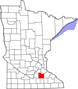
Website: www.co.rice.mn.us Das Rice County[2] ist ein County im US-amerikanischen Bundesstaat Minnesota. Bei der Volkszählung im Jahr 2010 hatte das County 64.142 Einwohner und eine Bevölkerungsdichte von 49,8 Einwohnern pro Quadratkilometer. Der Verwaltungssitz (County Seat) ist Faribault.
Das Rice County gehört zur CSA (Combined Statistical Area) Minneapolis - St. Paul - St. Cloud, der erweiterten Metropolregion Minneapolis - Saint Paul.
Inhaltsverzeichnis
Geografie
Das County liegt im mittleren Südosten von Minnesota und hat eine Fläche von 1.337 Quadratkilometern, wovon 48 Quadratkilometer Wasserfläche sind. Es grenzt an folgende Countys:
Scott County Dakota County Le Sueur County 
Goodhue County Waseca County Steele County Dodge County Geschichte
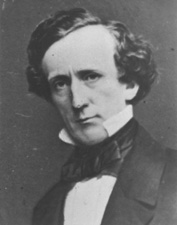
 H. M. Rice
Das Rice County wurde am 5. März 1853 aus Teilen des Dakota County und des Wabasha County gebildet. Benannt wurde es nach Henry Mower Rice (1816-1894), einem US-amerikanischen Politiker und von 1858 bis 1863 US-Senator von Minnesota.
Demografische Daten
Historische Einwohnerzahlen Census Einwohner ± in % 1860 7543 — 1870 16.083 100 % 1880 22.481 40 % 1890 23.968 7 % 1900 26.080 9 % 1910 25.911 -0,6 % 1920 28.307 9 % 1930 29.974 6 % 1940 32.160 7 % 1950 36.235 10 % 1960 38.988 8 % 1970 41.582 7 % 1980 46.087 10 % 1990 49.183 7 % 2000 56.665 20 % 2010 64.142 10 % Vor 1900[3] 1900–1990[4] 2000[5] 2010[6] Nach der Volkszählung im Jahr 2000 lebten im Rice County 56.665 Menschen in 18.888 Haushalten und 13.353 Familien. Die Bevölkerungsdichte betrug 44 Einwohner pro Quadratkilometer. Ethnisch betrachtet setzte sich die Bevölkerung zusammen aus 93,59 Prozent Weißen, 1,31 Prozent Afroamerikanern, 0,43 Prozent amerikanischen Ureinwohnern, 1,46 Prozent Asiaten, 0,04 Prozent Bewohnern aus dem pazifischen Inselraum und 1,87 Prozent aus anderen ethnischen Gruppen; 1,30 Prozent stammten von zwei oder mehr Ethnien ab. 5,50 Prozent der Bevölkerung waren spanischer oder lateinamerikanischer Abstammung, die verschiedenen der genannten Gruppen angehörten.
Von den 18.888 Haushalten hatten 36,5 Prozent Kinder unter 18 Jahren, die bei ihnen lebten. 58,1 Prozent davon waren verheiratete, zusammenlebende Paare. 8,6 Prozent waren alleinerziehende Mütter und 29,3 Prozent waren keine Familien. 23,9 Prozent waren Singlehaushalte und in 9,1 Prozent der Haushalte lebten alleinstehende Menschen im Alter von 65 Jahren oder darüber. Die Durchschnittshaushaltsgröße lag bei 2,65 Personen, die durchschnittliche Familiengröße bei 3,14 Personen.
25,3 Prozent der Bevölkerung waren unter 18 Jahre alt. 15,8 Prozent waren zwischen 18 und 24, 27,4 Prozent zwischen 25 und 44, 20,2 Prozent zwischen 45 und 64 und 11,4 Prozent waren älter als 65 Jahre. Das Durchschnittsalter betrug 33 Jahre. Auf 100 weibliche kamen statistisch 101,8 männliche Personen. Auf 100 Frauen im Alter von 18 Jahren oder darüber kamen 100,3 Männer.
Das jährliche Durchschnittseinkommen eines Haushalts betrug 48.651 USD und das Durchschnittseinkommen einer Familie betrug 56.407 USD. Männer hatten ein Durchschnittseinkommen von 36.771 USD, Frauen 26.151 USD. Das Pro - Kopf - Einkommen betrug 19.695 USD. 4,0 Prozent der Familien und 6,9 Prozent der Einwohner lebten unterhalb der Armutsgrenze.[7]
Städte und Gemeinden
- Dennison1
- Dundas
- Faribault
- Lonsdale
- Morristown
- Nerstrand
- Northfield2
1 - teilweise im Goodhue County
2 - teilweise im Dakota CountyEinzelnachweise
- ↑ Auszug aus dem National Register of Historic Places. Abgerufen am 13. März 2011
- ↑ GNIS-ID: 659511. Abgerufen am 22. Februar 2011 (englisch).
- ↑ U.S. Census Bureau _ Census of Population and Housing Abgerufen am 17. Februar 2011
- ↑ Auszug aus Census.gov Abgerufen am 17. Februar 2011
- ↑ Auszug aus factfinder.census.gov Abgerufen am 18. Februar 2011
- ↑ United States Census 2010 Abgerufen am 14. August 2011
- ↑ Rice County, Minnesota Datenblatt mit den Ergebnissen der Volkszählung im Jahre 2000 bei factfinder.census.gov
Weblinks
-
 Commons: Rice County, Minnesota – Sammlung von Bildern, Videos und Audiodateien
 - Offizielle Webseite
- Yahoo Bildersuche - Rice County
- www.city-data.com - Rice County

Liste der Countys in Minnesota
Aitkin | Anoka | Becker | Beltrami | Benton | Big Stone | Blue Earth | Brown | Carlton | Carver | Cass | Chippewa | Chisago | Clay | Clearwater | Cook | Cottonwood | Crow Wing | Dakota | Dodge | Douglas | Faribault | Fillmore | Freeborn | Goodhue | Grant | Hennepin | Houston | Hubbard | Isanti | Itasca | Jackson | Kanabec | Kandiyohi | Kittson | Koochiching | Lac qui Parle | Lake | Lake of the Woods | Le Sueur | Lincoln | Lyon | Mahnomen | Marshall | Martin | McLeod | Meeker | Mille Lacs | Morrison | Mower | Murray | Nicollet | Nobles | Norman | Olmsted | Otter Tail | Pennington | Pine | Pipestone | Polk | Pope | Ramsey | Red Lake | Redwood | Renville | Rice | Rock | Roseau | Scott | Sherburne | Sibley | St. Louis | Stearns | Steele | Stevens | Swift | Todd | Traverse | Wabasha | Wadena | Waseca | Washington | Watonwan | Wilkin | Winona | Wright | Yellow Medicine
Wikimedia Foundation.
Schlagen Sie auch in anderen Wörterbüchern nach:
Rice County, Minnesota — Location in the state of Minnesota … Wikipedia
National Register of Historic Places listings in Rice County, Minnesota — Location of Rice County in Minnesota This is a list of the National Register of Historic Places listings in Rice County, Minnesota. This is intended to be a complete list of the properties and districts on the National Register of Historic Places … Wikipedia
Morristown Township, Rice County, Minnesota — Morristown Township, Minnesota Township … Wikipedia
Northfield Township, Rice County, Minnesota — Northfield Township, Minnesota Township … Wikipedia
List of Registered Historic Places in Rice County, Minnesota — This is a List of Registered Historic Places in Rice County, Minnesota.Rice County is a county located in the southeastern part of the U.S. state of Minnesota, bounded on the... Its historic sites convey the county s significant historical trends … Wikipedia
Wheatland Township, Rice County, Minnesota — Infobox Settlement official name = Wheatland Township, Minnesota settlement type = Township nickname = motto = imagesize = image caption = image |pushpin pushpin label position =left pushpin map caption =Location within the state of Minnesota… … Wikipedia
Erin Township, Rice County, Minnesota — Infobox Settlement official name = Erin Township, Minnesota settlement type = Township nickname = motto = imagesize = image caption = image |pushpin pushpin label position =left pushpin map caption =Location within the state of Minnesota pushpin… … Wikipedia
Walcott Township, Rice County, Minnesota — Infobox Settlement official name = Walcott Township, Minnesota settlement type = Township nickname = motto = imagesize = image caption = image |pushpin pushpin label position =left pushpin map caption =Location within the state of Minnesota… … Wikipedia
Wheeling Township, Rice County, Minnesota — Infobox Settlement official name = Wheeling Township, Minnesota settlement type = Township nickname = motto = imagesize = image caption = image |pushpin pushpin label position =left pushpin map caption =Location within the state of Minnesota… … Wikipedia
Bridgewater Township, Rice County, Minnesota — Infobox Settlement official name = Bridgewater Township, Minnesota settlement type = Township nickname = motto = imagesize = image caption = image |pushpin pushpin label position =left pushpin map caption =Location within the state of Minnesota… … Wikipedia
Rice County (Minnesota)


18+
© Academic, 2000-2024
- Kontaktieren Sie uns: Unterstützung, Werbung
Wörterbücher Export, schritte mit PHP, Joomla, Drupal, WordPress, MODx.