- Raon-l’Étape
-
Raon-l’Étape 

Region Lothringen Département Vosges Arrondissement Saint-Dié-des-Vosges Kanton Raon-l’Étape Gemeindeverband Vallée de la Plaine Koordinaten 48° 24′ N, 6° 50′ O48.4058333333336.8411111111111285Koordinaten: 48° 24′ N, 6° 50′ O Höhe 285 m (279–610 m) Fläche 23,71 km² Einwohner 6.678 (1. Jan. 2008) Bevölkerungsdichte 282 Einw./km² Postleitzahl 88110 INSEE-Code 88372 
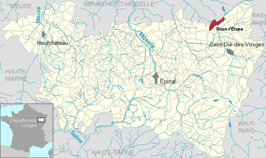
Lage von Raon-l’Étape im Département VosgesRaon-l’Étape ist eine französische Gemeinde mit 6678 Einwohnern (Stand 1. Januar 2008) im Département Vosges in der Region Lothringen. Sie ist Hauptort (chef-lieu) des gleichnamigen Kantons im Arrondissement Saint-Dié-des-Vosges und Sitz des départementübergreifenden Kommunalverbandes (Communauté de communes) Vallée de la Plaine.
Inhaltsverzeichnis
Geografie
Raon-l’Étape liegt an der Mündung der Plaine in die Meurthe. Saint-Dié-des-Vosges liegt 17, Épinal 44, Nancy 69 und Straßburg 88 Kilometer entfernt. Wälder nehmen fast 60 % des Gemeindegebietes ein. Bei Raon-l’Étape beginnt das Vallée de la Plaine.
Geschichte
Der Ort hieß im 13. Jahrhundert „Ravon“ - das bedeutet „Zusammenfluss“.
Bevölkerungsentwicklung
Jahr 1962 1968 1975 1982 1990 1999 2007 Einwohner 7606 7696 7741 7039 6780 6749 6710 Sehenswürdigkeiten
-
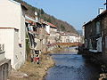
Die Plaine in Raon-l’Étape
-

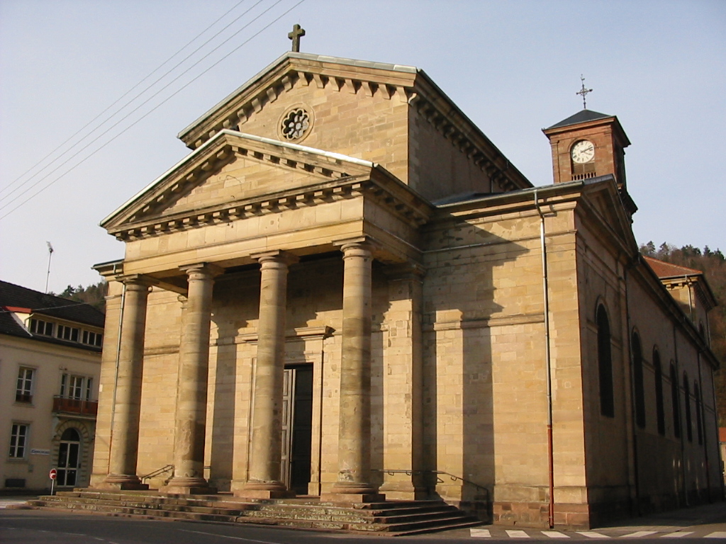
Kirche Saint-Luc
-

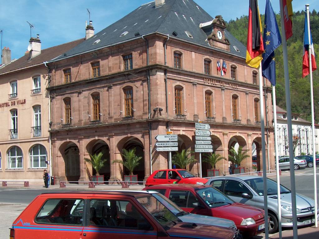
Rathaus
-

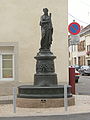
Brunnen „Ziege von Raon-l’Étape“
-
Brunnen „La Concorde“
Wirtschaft
Neben dem Handel und dem Kleingewerbe wurde auch Industrie angesiedelt: Papierfabriken, Gießereien, Maschinenbau, Kunststoff, Textil, Konfektion, Telekommunikation und andere Branchenzweige.
Sport
Der ortsansässige Fußballclub US Raon spielt in der Fußballmeisterschaft für Amateurmannschaften und trägt seine Heimspiele im Stade Paul Gasser aus.
Weblinks
 Commons: Raon-l'Étape – Sammlung von Bildern, Videos und AudiodateienGemeinden im Kommunalverband Vallée de la Plaine
Allarmont | Bionville | Celles-sur-Plaine | Luvigny | Pierre-Percée | Raon-lès-Leau | Raon-l’Étape | Raon-sur-Plaine | Vexaincourt
Wikimedia Foundation.
Schlagen Sie auch in anderen Wörterbüchern nach:
Raon-L'Étape — Raon l’Étape La Plaine à Raon l Étape. Détail Administration … Wikipédia en Français
Raon-l'Etape — Raon l Étape Raon l’Étape La Plaine à Raon l Étape. Détail Administration … Wikipédia en Français
Raon-l'étape — Raon l’Étape La Plaine à Raon l Étape. Détail Administration … Wikipédia en Français
Raon l'Etape — Raon l Étape Raon l’Étape La Plaine à Raon l Étape. Détail Administration … Wikipédia en Français
Raon l'étape — Raon l’Étape La Plaine à Raon l Étape. Détail Administration … Wikipédia en Français
Raon l'Etape — (spr. Raong letapp), Marktflecken im Arrondissement St. Diey im französischen Departement Vogesen; Brauerei, Gerberei, Leinweberei; 3500 Ew … Pierer's Universal-Lexikon
Raon-l'Etape — (spr. rang letapp ), Stadt im franz. Depart. Vogesen, Arrond. St. Die, 285 m ü. M., an der Meurthe, die hier die Plaine aufnimmt, an der Ostbahn, hat Schloßruinen, Eisengießerei, Fabrikation von Papier, Strohhüten, Spitzen und Töpferwaren,… … Meyers Großes Konversations-Lexikon
Raon-l'Étape — 48° 24′ 24″ N 6° 50′ 31″ E / 48.40667, 6.84194 … Wikipédia en Français
Raon-l'Étape — French commune nomcommune=Raon l Étape in Raon l Étape région=Lorraine département=Vosges arrondissement=Saint Dié des Vosges canton=Raon l Étape insee=88372 cp=88110 maire=Michel Humbert mandat= intercomm=Communauté de communes de la Vallée de… … Wikipedia
Gare de Raon-l'Étape — Raon l Étape La gare du côté du square Marcel Husson Localisation Pays … Wikipédia en Français
-
Raon-l’Étape


18+
© Academic, 2000-2024
- Kontaktieren Sie uns: Unterstützung, Werbung
Wörterbücher Export, schritte mit PHP, Joomla, Drupal, WordPress, MODx.