Pruchnik

Pruchnik
Pruchnik
Wappen fehlt
Hilfe zu Wappen
Pruchnik (Polen)
Pruchnik
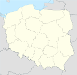
Pruchnik
Basisdaten
Staat: Polen
Woiwodschaft: Karpatenvorland
Landkreis: Jarosław
Geographische Lage: 49° 55′ N, 22° 31′ O49.91666666666722.516666666667Koordinaten: 49° 55′ 0″ N, 22° 31′ 0″ O
Einwohner:

-
(31. Dez. 2010)[1]

Postleitzahl: 37-560
Telefonvorwahl: (+48) 16
Kfz-Kennzeichen: RJA
Wirtschaft und Verkehr
Nächster int. Flughafen: Rzeszów-Jasionka
Gemeinde
Gemeindeart: Stadt- und Landgemeinde
Fläche: 78,3 km²
Einwohner:

9855
(31. Dez. 2010) [2]

Bevölkerungsdichte: 126 Einw./km²
Gemeindenummer (GUS): 1804072
Verwaltung (Stand: 2007)
Gemeindevorsteher: Stanisław Górski
Adresse: Rynek 1
37-560 Pruchnik

Pruchnik ist eine Stadt mit 3.300 Einwohnern in Polen. Es liegt 19 km südwestlich von Jarosław an der Mleczka und gehört dem Powiat Jarosławski in der Woiwodschaft Karpatenvorland an. Pruchnik ist vor allem für die zahlreichen sehenswerten Holzhäuser mit Bogengängen aus dem 19. Jahrhundert bekannt.

Inhaltsverzeichnis

Geschichte

Der Ort wurde 1299 erstmals erwähnt. 1370 erhielt Pruchnik, das sich im Besitz der Familie Pruchnicki befand, Stadtrecht. 1772, bei der Ersten Teilung Polens kam die Stadt zu Österreich. Im Jahre 1935 wurden dem Ort die Stadtrechte entzogen. Zum 1. Januar 2011 erhielt der Ort wieder Stadtrecht.[3]

Gmina

Die Stadt- und Landgemeinde (gmina miejsko-wiejska) Pruchnik umfasst ein Gebiet von 78,26 km² mit 9.536 Einwohnern. Dazu gehören folgende Ortschaften:

  • Hawłowice
  • Jodłówka
  • Jodłówka Parcelacja
  • Kramarzówka
  • Pruchnik
  • Rozbórz Długi
  • Rozbórz Okrągły
  • Rzeplin
  • Świebodna

Verweise

Weblinks

Fußnoten

  1. Population. Size and Structure by Territorial Division. As of December 31, 2010. Główny Urząd Statystyczny (GUS), abgerufen am 1. Juli 2011.
  2. Population. Size and Structure by Territorial Division. As of December 31, 2010. Główny Urząd Statystyczny (GUS), abgerufen am 1. Juli 2011.
  3. Website des Sejm, Dz.U. 2010 nr 138 poz. 929, abgerufen am 1. Januar 2011

Wikimedia Foundation.

Игры ⚽ Поможем решить контрольную работу

Schlagen Sie auch in anderen Wörterbüchern nach:

  • Pruchnik — Infobox Settlement name = Pruchnik settlement type = Village total type = image shield = subdivision type = Country subdivision name = POL subdivision type1 = Voivodeship subdivision name1 = Subcarpathian subdivision type2 = County subdivision… …   Wikipedia

  • Pruchnik — Original name in latin Pruchnik Name in other language Pruchnik, Pruchnik Miasto State code PL Continent/City Europe/Warsaw longitude 49.9062 latitude 22.51554 altitude 245 Population 3694 Date 2011 01 08 …   Cities with a population over 1000 database

  • Gmina Pruchnik — Infobox Settlement name = Gmina Pruchnik other name = Pruchnik Commune settlement type = Gmina total type = Total image shield = POL gmina Pruchnik COA.svg subdivision type = Country subdivision name = POL subdivision type1 = Voivodeship… …   Wikipedia

  • Hawłowice — Infobox Settlement name = Hawłowice settlement type = Village total type = image shield = image caption = Greek Catholic church subdivision type = Country subdivision name = POL subdivision type1 = Voivodeship subdivision name1 = Subcarpathian… …   Wikipedia

  • Jodłówka, Subcarpathian Voivodeship — Infobox Settlement name = Jodłówka settlement type = Village total type = image shield = subdivision type = Country subdivision name = POL subdivision type1 = Voivodeship subdivision name1 = Subcarpathian subdivision type2 = County subdivision… …   Wikipedia

  • Kramarzówka — Infobox Settlement name = Kramarzówka settlement type = Village total type = image shield = subdivision type = Country subdivision name = POL subdivision type1 = Voivodeship subdivision name1 = Subcarpathian subdivision type2 = County subdivision …   Wikipedia

  • Rozbórz Długi — Infobox Settlement name = Rozbórz Długi settlement type = Village total type = image shield = subdivision type = Country subdivision name = POL subdivision type1 = Voivodeship subdivision name1 = Subcarpathian subdivision type2 = County… …   Wikipedia

  • Rozbórz Okrągły — Infobox Settlement name = Rozbórz Okrągły settlement type = Village total type = image shield = subdivision type = Country subdivision name = POL subdivision type1 = Voivodeship subdivision name1 = Subcarpathian subdivision type2 = County… …   Wikipedia

  • Rzeplin, Subcarpathian Voivodeship — Infobox Settlement name = Rzeplin settlement type = Village total type = image shield = subdivision type = Country subdivision name = POL subdivision type1 = Voivodeship subdivision name1 = Subcarpathian subdivision type2 = County subdivision… …   Wikipedia

  • Świebodna — Infobox Settlement name = Świebodna settlement type = Village total type = image shield = subdivision type = Country subdivision name = POL subdivision type1 = Voivodeship subdivision name1 = Subcarpathian subdivision type2 = County subdivision… …   Wikipedia

Share the article and excerpts

Direct link
Do a right-click on the link above
and select “Copy Link”