- Portage County (Wisconsin)
-
Verwaltung US-Bundesstaat: Wisconsin Verwaltungssitz: Stevens Point Adresse des
Verwaltungssitzes:County Courthouse
1516 Church Street
Stevens Point, WI 54481-3501Gründung: 7. Dezember 1836 Gebildet aus: Brown County
Crawford County
Iowa County
Milwaukee CountyVorwahl: 001 715 Demographie Einwohner: 70.019 (2010) Bevölkerungsdichte: 33,5 Einwohner/km² Geographie Fläche gesamt: 2.131 km² Wasserfläche: 43 km² Karte 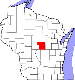
Website: www.co.portage.wi.us Portage County[1] ist ein County im Bundesstaat Wisconsin der Vereinigten Staaten von Amerika. Bei der Volkszählung im Jahr 2010 hatte das County 70.019 Einwohner und eine Bevölkerungsdichte von 33,5 Einwohnern pro Quadratkilometer. Der Verwaltungssitz (County Seat) ist Stevens Point, das nach George Stevens, einem frühen Siedler in diesem Gebiet, benannt wurde.
Inhaltsverzeichnis
Geografie
Das County liegt leicht östlich des geographischen Zentrums von Wisconsin und hat eine Fläche von 2131 Quadratkilometern, wovon 43 Quadratkilometer Wasserfläche sind. Es grenzt an folgende Countys:
Marathon County Shawano County Wood County 
Waupaca County Adams County Waushara County Geschichte
Portage County wurde am 7. Dezember 1836 aus Teilen des Brown County, Crawford County, Iowa County und Milwaukee County gebildet. Benannt wurde es nach Wasserscheide (französisch: Portage - Übergang) zwischen dem Fox River und dem Wisconsin River.
Demografische Daten
Historische Einwohnerzahlen Census Einwohner ± in % 1900 29.483 — 1910 30.945 5 % 1920 33.649 9 % 1930 33.827 0,5 % 1940 35.800 6 % 1950 34.858 -3 % 1960 36.964 6 % 1970 47.541 30 % 1980 57.420 20 % 1990 61.405 7 % 2000 67.182 9 % 2010 70.019 4 % 1900–1990[2] 2010[3]  Alterspyramide (2000) des Portage County
Nach der Volkszählung im Jahr 2000 lebten im Portage County 67.182 Menschen in 25.040 Haushalten. 16.501 Familien lebten im County. Die Bevölkerungsdichte betrug 32 Personen pro Quadratkilometer. Ethnisch betrachtet setzte sich die Bevölkerung zusammen aus 95,73 Prozent Weißen, 0,32 Prozent Afroamerikanern, 0,36 Prozent amerikanischen Ureinwohnern, 2,25 Prozent Asiaten, 0,04 Prozent Bewohnern aus dem pazifischen Inselraum und 0,43 Prozent aus anderen ethnischen Gruppen; 0,86 Prozent stammten von zwei oder mehr Ethnien ab. 1,44 Prozent der Bevölkerung waren spanischer oder lateinamerikanischer Abstammung, die verschiedenen der genannten Gruppen angehörten.
Von den 25.040 Haushalten hatten 32,1 Prozent Kinder unter 18 Jahren, die mit ihnen zusammen lebten. 55,1 Prozent davon waren verheiratete, zusammenlebende Paare, 7,3 Prozent waren allein erziehende Mütter. 34,1 Prozent waren keine Familien. 24,5 Prozent waren Singlehaushalte und in 8,8 Prozent lebten Menschen mit 65 Jahren oder älter. Die durchschnittliche Haushaltsgröße lag bei 2,54 und die durchschnittliche Familiengröße bei 3,07 Personen.
24,1 Prozent der Bevölkerung waren unter 18 Jahre alt, 16,2 Prozent zwischen 18 und 24, 27,7 Prozent zwischen 25 und 44, 21,1 Prozent zwischen 45 und 64, und 10,9 Prozent waren 65 Jahre oder älter. Das Durchschnittsalter betrug 33 Jahre. Auf 100 weibliche kamen statistisch 99,4 männliche Personen.[4]
Städte und Gemeinden
- Almond
- Amherst
- Amherst Junction
- Junction City
- Milladore1
- Nelsonville
- Park Ridge
- Plover
- Rosholt
- Stevens Point
- Whiting
1 - teilweise im Wood County
Einzelnachweise
- ↑ Portage County im Geographic Names Information System des United States Geological Survey Abgerufen am 22. Februar 2011
- ↑ Auszug aus Census.gov Abgerufen am 28. Februar 2011
- ↑ United States Census 2010 Abgerufen am 11. April 2011
- ↑ Portage County, Wisconsin Datenblatt mit den Ergebnissen der Volkszählung im Jahre 2000 bei factfinder.census.gov
Weblinks
-
 Commons: Portage County, Wisconsin – Sammlung von Bildern, Videos und Audiodateien
 - Offizielle Webseite
- www.city-data.com

Liste der Countys in Wisconsin
Adams | Ashland | Barron | Bayfield | Brown | Buffalo | Burnett | Calumet | Chippewa | Clark | Columbia | Crawford | Dane | Dodge | Door | Douglas | Dunn | Eau Claire | Florence | Fond du Lac | Forest | Grant | Green | Green Lake | Iowa | Iron | Jackson | Jefferson | Juneau | Kenosha | Kewaunee | La Crosse | Lafayette | Langlade | Lincoln | Manitowoc | Marathon | Marinette | Marquette | Menominee | Milwaukee | Monroe | Oconto | Oneida | Outagamie | Ozaukee | Pepin | Pierce | Polk | Portage | Price | Racine | Richland | Rock | Rusk | Sauk | Sawyer | Shawano | Sheboygan | St. Croix | Taylor | Trempealeau | Vernon | Vilas | Walworth | Washburn | Washington | Waukesha | Waupaca | Waushara | Winnebago | Wood
Wikimedia Foundation.
Schlagen Sie auch in anderen Wörterbüchern nach:
Portage County, Wisconsin — Infobox U.S. County county = Portage County state = Wisconsin founded year = 1841 [ [http://www.pchswi.org/archives/townships/origins.html Origins of Portage County ] ] largest city wl = Stevens Point seat wl = Stevens Point area total sq mi =… … Wikipedia
National Register of Historic Places listings in Portage County, Wisconsin — Buildings, sites, districts, and objects in Portage County listed on the National Register of Historic Places See also: National Register of Historic Places listings in Wisconsin This National Park Service list is complete through NPS recent… … Wikipedia
Dewey, Portage County, Wisconsin — Dewey, Wisconsin Town Location of Dewey, Portage County, Wisconsin … Wikipedia
Belmont, Portage County, Wisconsin — Infobox Settlement official name = Belmont, Wisconsin settlement type = Town nickname = motto = imagesize = image caption = image mapsize = 250px map caption = Location of Belmont, Portage County, Wisconsin mapsize1 = map caption1 = subdivision… … Wikipedia
Buena Vista, Portage County, Wisconsin — Infobox Settlement official name = Buena Vista, Wisconsin settlement type = Town nickname = motto = imagesize = image caption = image mapsize = 250px map caption = Location of Buena Vista, Portage County, Wisconsin mapsize1 = map caption1 =… … Wikipedia
Eau Pleine, Portage County, Wisconsin — Infobox Settlement official name = Eau Pleine, Wisconsin settlement type = Town nickname = motto = imagesize = image caption = image mapsize = 250px map caption = Location of Eau Pleine, Portage County, Wisconsin mapsize1 = map caption1 =… … Wikipedia
Grant, Portage County, Wisconsin — Infobox Settlement official name = Grant, Wisconsin settlement type = Town nickname = motto = imagesize = image caption = image mapsize = 250px map caption = Location of Grant, Portage County, Wisconsin mapsize1 = map caption1 = subdivision type … Wikipedia
Hull, Portage County, Wisconsin — Infobox Settlement official name = Hull, Wisconsin settlement type = Town nickname = motto = imagesize = image caption = image mapsize = 250px map caption = Location of Hull, Portage County, Wisconsin mapsize1 = map caption1 = subdivision type =… … Wikipedia
Sharon, Portage County, Wisconsin — Infobox Settlement official name = Sharon, Wisconsin settlement type = Town nickname = motto = imagesize = image caption = image mapsize = 250px map caption = Location of Sharon, Portage County, Wisconsin mapsize1 = map caption1 = subdivision… … Wikipedia
Pine Grove, Portage County, Wisconsin — Pine Grove is a town in Portage County, Wisconsin, United States. The population was 904 at the 2000 census.Geography), of which, 37.7 square miles (97.5 km²) of it is land and 0.04 square miles (0.1 km²) of it (0.11%) is water.DemographicsAs of… … Wikipedia
Portage County (Wisconsin)


18+
© Academic, 2000-2024
- Kontaktieren Sie uns: Unterstützung, Werbung
Wörterbücher Export, schritte mit PHP, Joomla, Drupal, WordPress, MODx.