Port Stephens Council

Port Stephens Council
Port Stephens
Australia-Map-NSW-LGA-PortStephens.png
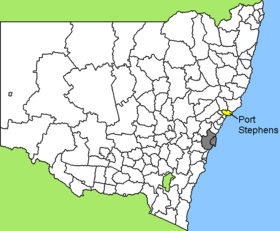
Lage des Port Stephens Council in New South Wales
Gliederung
Staat: Australien Australien
Bundesstaat: Flag of New South Wales.svg New South Wales
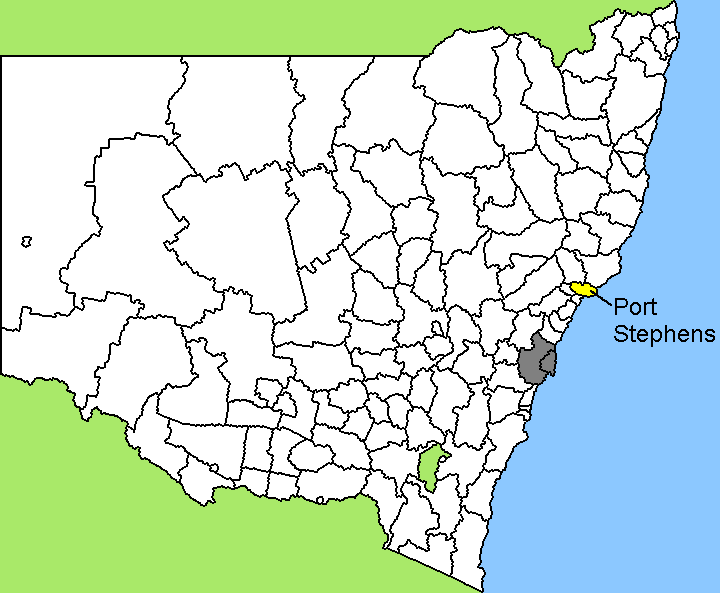
Verwaltungssitz: Raymond Terrace
Daten und Zahlen
Fläche: 858 km²
Einwohner: 60.484 (2006) [1]
Bevölkerungsdichte: 70 Einwohner je km²
Wards: 3
-32.733333333333151.95

Port Stephens ist ein lokales Verwaltungsgebiet (LGA) im australischen Bundesstaat New South Wales. Das Gebiet ist 858 km² groß und hat etwa 60.000 Einwohner.

Port Stephens liegt an der Ostküste des Staates 200 km nordöstlich der Metropole Sydney. Das Gebiet umfasst 74 Ortsteile und Ortschaften, darunter Anna Bay, Balickera, Boat Harbour, Bobs Farm, Brandy Hill, Butterwick, Campvale, Corlette, Duns Creek, Eagleton, East Seaham, Fern Bay, Ferodale, Fingal Bay, Fishermans Bay, Fullerton Cove, Heatherbrae, Hinton, Lemon Tree Passage, Mallabula, Medowie, Nelson Bay, Nelsons Plains, One Mile, Osterley, Oyster Cove, Raymond Terrace, Salamander Bay, Salt Ash, Seaham, Shoal Bay, Soldiers Point, Swan Bay, Tanilba Bay, Taylors Beach, Tomago, Twelve Mile Creek, Wallalong und Williamtown sowie Teile von Glen Oak, Karuah und Woodville. Der Verwaltungssitz des Councils befindet sich in der Stadt Raymond Terrace am Westrand der LGA, wo etwa 12.700 Einwohner leben.

Verwaltung

Der Council von Port Stephens hat zwölf Mitglieder, die von den Bewohnern der drei Wards gewählt werden (je drei aus dem Central, dem East und dem West Ward). Diese drei Bezirke sind unabhängig von den Ortschaften festgelegt. Aus dem Kreis der Councillor rekrutiert sich auch der Mayor (Bürgermeister) des Councils.

Weblinks

Einzelnachweise

  1. Australian Bureau of Statistics (25. Oktober 2007): Port Stephens (A) (Local Government Area) (Englisch). 2006 Census QuickStats. Abgerufen am 6. April 2010.

Wikimedia Foundation.

Игры ⚽ Нужен реферат?

Schlagen Sie auch in anderen Wörterbüchern nach:

  • Port Stephens Council — Infobox Australian Place type = lga name = Port Stephens Council city = state = nsw caption = loc x = 193 loc y = 86 pop = 60,484 pop footnotes = [Census 2006 AUS | id = LGA16400 | name = Port Stephens (A) (Local Government Area) | quick = on |… …   Wikipedia

  • Port Stephens Pythons — Port Stephens Cricket Club was founded in 1987 by members of the Port Stephens Council. The Club was originally known as the Port Stephens Council Cricket Club, or simply P.S.C.C.C. Over the years many other members joined external to council… …   Wikipedia

  • Port Stephens — Infobox Ocean Ocean name = Port Stephens image Ocean = portstephens entrance.jpg caption Ocean = Yacaba, the northern headland at the entrance of Port Stephens image bathymetry = caption bathymetry = location = New South Wales coords =… …   Wikipedia

  • Electoral district of Port Stephens — Port Stephens is an electoral district of the Legislative Assembly in the Australian state of New South Wales. It is represented by Craig Baumann of the Liberal Party. It is the most marginal seat in NSW, with Mr. Baumann winning by a margin of… …   Wikipedia

  • Port of Hull — Coordinates: 53°44′17″N 0°19′55″W / 53.738°N 0.332°W / 53.738; 0.332 …   Wikipedia

  • Great Lakes Council — Infobox Australian Place | type = lga name = Great Lakes Council state = nsw caption = Location in New South Wales pop = 34,695 [cite web publisher = Australian Bureau of Statistics title=Regional Population Growth, Australia, 2004 05 url =… …   Wikipedia

  • Marrickville Council — New South Wales Population: 78,271(2009) …   Wikipedia

  • Burwood Council — New South Wales Population: 33,803(2009) …   Wikipedia

  • Manly Council — New South Wales Population: 40 …   Wikipedia

  • North Sydney Council — New South Wales Population: 63,914(2009) …   Wikipedia

Share the article and excerpts

Direct link
Do a right-click on the link above
and select “Copy Link”