Ponta do Sol

Ponta do Sol

Vorlage:Infobox Município/Wartung/Verwaltungname ist leer Vorlage:Infobox Município/Wartung/Verwaltungstraße ist leer Vorlage:Infobox Município/Wartung/Verwaltungadresse ist leer Vorlage:Infobox Município/Wartung/Verwaltungort ist leer Vorlage:Infobox Município/Wartung/Kreisrat ist leer Vorlage:Infobox Município/Wartung/Webseite ist leer Vorlage:Infobox Município/Wartung/EMail ist leer

Ponta do Sol
Wappen Karte
Wappen von Ponta do Sol
Ponta do Sol (Madeira)
Ponta do Sol
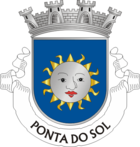
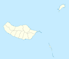
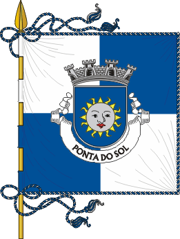
Basisdaten
Autonome Region: Madeira
Concelho: Ponta do Sol
Koordinaten: 32° 41′ N, 17° 6′ W32.681666666667-17.101666666667Koordinaten: 32° 41′ N, 17° 6′ W
Kreis Ponta do Sol
Flagge Karte
Flagge von Ponta do Sol Position des Kreises Ponta do Sol
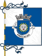
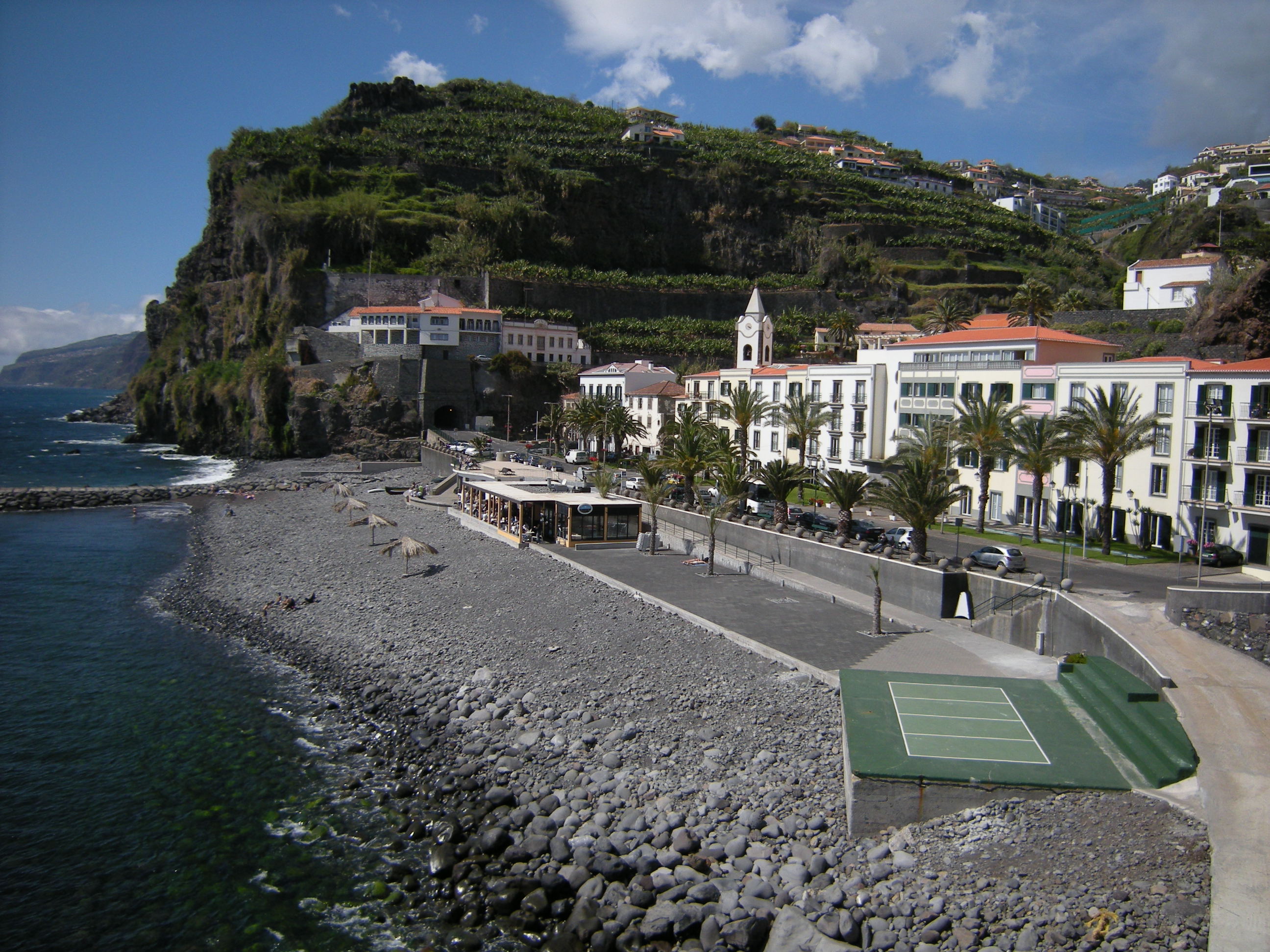
Einwohner: 8853 (Stand: 2011)
Fläche: 43,8 km²
Bevölkerungsdichte: 202,12 Einwohner pro km²
Anzahl der Gemeinden: 3


Vorlage:Infobox Ort in Portugal/Wartung/Karte ist leer


Vorlage:Infobox Ort in Portugal/Wartung/Einwohner ist leer Vorlage:Infobox Ort in Portugal/Wartung/Fläche ist leer Vorlage:Infobox Ort in Portugal/Wartung/Höhe ist leer Vorlage:Infobox Ort in Portugal/Wartung/PLZ ist leer Vorlage:Infobox Ort in Portugal/Wartung/Bürgermeister ist leer

Vorlage:Infobox Ort in Portugal/Wartung/Einwohnerstand ist leer

Vorlage:Infobox Ort in Portugal/Wartung/Verwaltungsort ist leer Vorlage:Infobox Ort in Portugal/Wartung/Webseite ist leer Vorlage:Infobox Ort in Portugal/Wartung/Email ist leer

Ponta do Sol [ˈpõtɐ ðu ˈsɔɫ] ist ein Kreis im Südwesten der portugiesischen Insel Madeira. Hauptort ist der 4224 Einwohner (Stand 2001) zählende gleichnamige Ort Ponta do Sol.
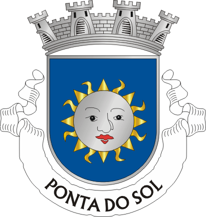
Wappen Ort

In Blau eine silberne Sonne mit Gesicht und rotem Mund und goldenen geraden und geflammten Strahlen. Über den Schild eine silberne viertürmige Mauerkrone. Im weißen Band am Schildfuß der Ortsname in schwarzen Buchstaben „PONTA DO SOL“.

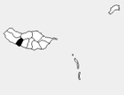
Er ist in drei Gemeinden (Freguesias) aufgeteilt:

Gemeinde Einwohner Fläche Bev.dichte Höhe Geogr. Lage
Canhas 3 214 13.3 km² 241.7/km² Atlantischer Ozean 32°40' N
17°7' W
Madalena do Mar 687 2.3 km² 298.7/km² Atlantischer Ozean 32°41' N
17°8' W
Ponta do Sol 4 224 28.2 km² 149.8/km² Atlantischer Ozean 32°40' N
17°6' W
Porto Moniz São Vicente
Calheta Nachbargemeinden Ribeira Brava
Atlantischer Ozean
Ponta do Sol

Weblinks

 Commons: Ponta do Sol – Sammlung von Bildern, Videos und Audiodateien

Wikimedia Foundation.

Игры ⚽ Поможем решить контрольную работу

Schlagen Sie auch in anderen Wörterbüchern nach:

  • Ponta do Sol — Saltar a navegación, búsqueda Ponta do Sol Municipio de Portugal …   Wikipedia Español

  • Ponta do sol — Vue du centre de Ponta do Sol. Ponta do Sol …   Wikipédia en Français

  • Ponta do Sol — (Portugués par punta de sol) es una ciudad en la isla de Madeira, cuya población es de 8 125 habitantes (2001). ● Localización:    ◯ Latitud: 32.667 (32°40 ) N    ◯ Longitud: 17.1 (17°6 ) W Las 3 parroquias de incluyen: ==Estabelecimentes== > …   Enciclopedia Universal

  • Ponta do Sol — Vue du centre de Ponta do Sol. Ponta do Sol …   Wikipédia en Français

  • Ponta do Sol — 1 Original name in latin Ponta do Sol Name in other language Sol Point State code CV Continent/City Atlantic/Cape Verde longitude 17.19942 latitude 25.09192 altitude 35 Population 4064 Date 2010 05 31 2 Original name in latin Ponta do Sol Name in …   Cities with a population over 1000 database

  • Ponta do Sol — Admin ASC 2 Code Orig. name Ponta do Sol Country and Admin Code PT.10.3105 PT …   World countries Adminstrative division ASC I-II

  • Ponta do Sol (freguesia) — Ponta do Sol Administration Pays  Portugal …   Wikipédia en Français

  • Ponta do Sol Praia Hotel — (Натал,Бразилия) Категория отеля: 4 звездочный отель Адрес: Pituba, 3165, П …   Каталог отелей

  • Ponta do Sol (Boa Vista) — Ponta do Sol (Portuguese meaning the sun point Capeverdean Crioulo: Punta du Sol , São Vicente: Ponta d Sol ) is a point located in the northwest of the island of Boa Vista and it represents the island s northernmost point in Cape Verde. Distance …   Wikipedia

  • Ponta do Sol, Cape Verde — Ponta do Sol (Portuguese for the point of the sun ) is the small fishing town situated in the northern part of the island municipality of Santo Antão, Cape Verde. The town is the 12th largest city in Cape Verde and is one of the few cities in… …   Wikipedia

Share the article and excerpts

Direct link
Do a right-click on the link above
and select “Copy Link”