- Peros Banhos
-
Peros Banhos Landsat-Falschfarbenbild des Peros-Banhos-Atolls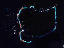
Gewässer Indischer Ozean Archipel Chagos-Archipel Geographische Lage 5° 20′ S, 71° 51′ O-5.333333333333371.85Koordinaten: 5° 20′ S, 71° 51′ O 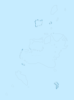

Anzahl der Inseln 32 Hauptinsel Île du Coin Landfläche 13 km² Gesamtfläche 503 km² Einwohner (unbewohnt) Karte des Chagos-Archipels mit Peros Banhos
Peros Banhos ist ein Atoll im Indischen Ozean, welches geographisch zum Chagos-Archipel gehört. Zu den Inseln von Peros Banhos gehören unter anderem Grande Soeur, Île du Coin, Île Diamant und Île Yeye. Politisch gehört das Atoll zum britischen Territorium im Indischen Ozean.
Die Inselgruppe wurde ungefähr um 1500 entdeckt, wobei unklar ist, ob von Alfonso d'Albuquerque oder von Ludovico di Varthema, der auch Diego Garcia entdeckt hatte. Später wurde sie von den Franzosen besetzt und von Mauritius aus verwaltet. In Folge der napoleonischen Kriege wurde sie an Großbritannien übergeben.
1965 verpachteten die Briten Peros Banhos und weitere Inselgruppen der Chagos-Inseln, so etwa Diego Garcia, für 50 Jahre an die USA. Die Inselbewohner (Chagossianer) wurden daraufhin zwangsumgesiedelt, der Zutritt zum Atoll ist strikt untersagt. Der östliche Teil des Atolls, östlich von Moresby Island im Norden und Fouquet Island im Süden, gehört heute zum Peros Banhos Atoll Strict Nature Reserve.
- Karten
-

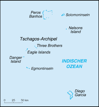
Karte des Atolls Peros Banhos
-

Peros Banhos Atoll Strict Nature Reserve
Kategorien:- Inselgruppe (Indischer Ozean)
- Inselgruppe (Britisches Territorium im Indischen Ozean)
- Inselgruppe ohne Kontinentalbezug
- Unbewohnte Inselgruppe
- Atoll


Wikimedia Foundation.