Atlin Lake

Atlin Lake
Atlin Lake

Photo-request.svg

Bild gesucht 

BW

Geographische Lage British Columbia, Yukon-Territorium (Kanada)
Abfluss Yukon River
Inseln Teresa Island
Orte am Ufer Atlin
Daten
Koordinaten 59° 30′ 0″ N, 133° 45′ 0″ W59.5-133.75668Koordinaten: 59° 30′ 0″ N, 133° 45′ 0″ W
Atlin Lake (Kanada)
Atlin Lake
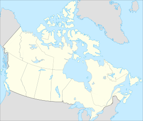
Höhe über Meeresspiegel 668 m
Fläche 798 km²f5
Länge 145 kmf6
Maximale Tiefe 283 mf10
Besonderheiten

der höchste Gipfel auf einer Insel in einem Süßwasser-See

Der Atlin Lake ist der größte natürliche See der kanadischen Provinz British Columbia.

Der 145 km lange See besitzt eine Fläche von 798 km², der Seespiegel befindet sich 668 m über dem Meeresspiegel, die maximale Tiefe beträgt 283 m. Andere Angaben lauten: 589 km² Wasserfläche, 775 km² Gesamtfläche einschließlich Inseln.[1]

Auf Teresa Island befindet sich der 2.060 m hohe Birch Mountain, der höchste Gipfel auf einer Insel in einem Süßwasser-See; diese Insel ist – ebenso wie der gesamte Süden des Sees und seine Umgebung – Teil des Atlin Provincial Park.

Der Name leitet sich von dem Tlingit-Ausdruck Aa Tlein für „großes Gewässer“ ab.

Der Atlin Lake gilt offiziell als Quelle des Yukon River.[2]

Östlich des Sees liegt das Atlin-Vulkanfeld.

Einzelnachweise

  1. Natural Resources Canada - Atlas of Canada - Lakes
  2. Atlin Lake im Geographic Names Information System des United States Geological Survey

Wikimedia Foundation.

Игры ⚽ Нужна курсовая?

Schlagen Sie auch in anderen Wörterbüchern nach:

  • Atlin Lake — Infobox lake lake name = Atlin Lake image lake = Tagish Lake.jpg caption lake = A portion of Atlin Lake (on the right half of the image) during the winter, as seen from space. The lake seen on the left half of the image is Tagish Lake image… …   Wikipedia

  • Atlin Lake — Sp Ãtlino ẽžeras Ap Atlin Lake L Kanadoje (Britų Kolumbija) …   Pasaulio vietovardžiai. Internetinė duomenų bazė

  • Atlin — Lage in British Columbia …   Deutsch Wikipedia

  • Atlin, British Columbia — Atlin is a community in northwestern British Columbia, Canada, located on Atlin Lake. It can be reached from an unnumbered road in British Columbia that connects with the Atlin Road, Yukon territorial highway 7. As of 2004, there are 450… …   Wikipedia

  • Atlin — may either be:*Atlin Lake, one of British Columbia s largest lakes *Atlin, British Columbia, a town in the far northwest of British Columbia, named for the lake *the Atlin Gold Rush, a Klondike era gold rush in British Columbia, centred on the… …   Wikipedia

  • Atlin Road — Die Atlin Road ist eine Straße in British Columbia und dem Yukon Territory, welche die Siedlung Atlin mit der Tagish Road nahe Jake s Corner am Alaska Highway verbindet. Inhaltsverzeichnis 1 Baugeschichte 2 Verlauf 2.1 Discovery Road …   Deutsch Wikipedia

  • Atlin Short Line Railway and Navigation — White Pass Yukon Rwy., Stand 2006[1] Legende …   Deutsch Wikipedia

  • Atlin Southern Railway — White Pass Yukon Rwy., Stand 2006[1] Legende …   Deutsch Wikipedia

  • Atlin District — The Atlin District, also known as the Atlin Country, is a historical region located in the far northwestern corner of the Canadian province of British Columbia, centred on Atlin Lake and the gold rush capital of the region, the town of Atlin. The …   Wikipedia

  • Atlin Provincial Park and Recreation Area — Infobox protected area | name = Atlin Provincial Park and Recreation Area iucn category = caption = Location of Atlin Provincial Park in British Columbia locator x = 51 locator y = 30 location = British Columbia, Canada nearest city = Atlin,… …   Wikipedia

Share the article and excerpts

Direct link
Do a right-click on the link above
and select “Copy Link”