Newtownabbey

Newtownabbey
Newtownabbey
irisch Baile Nua na Mainistreach
Koordinaten 54° 39′ N, 5° 54′ W54.657-5.907Koordinaten: 54° 39′ N, 5° 54′ W
Newtownabbey (Nordirland)
Newtownabbey
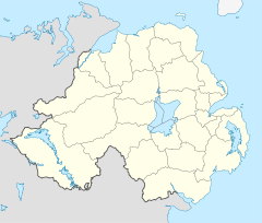
Newtownabbey
Bevölkerung 61.713 (2008)[1]
Verwaltung
Landesteil Nordirland
Counties County Antrim
Unitary authority Newtownabbey Borough

Newtownabbey (irisch: Baile na Mainistreach) ist neben Lisburn die größte Vorstadt der nordirischen Hauptstadt Belfast, an das es nördlich angrenzt. Newtownabbey liegt in der Grafschaft Antrim und ist Verwaltungssitz des Districts Newtownabbey, dem außer Newtownabbey noch die Ortschaften Carnmoney, Glengormley, Jordanstown, Monkstown, Rathcoole und Whiteabbey angehören.

Newtownabbey befindet sich am Nordwestufer des Belfast Lough, der Bucht, an der auch Belfast liegt. Die Stadt wurde 1958 als New Town durch den Zusammenschluss einiger kleinerer Gemeinden gebildet. Es handelt sich um eine typische Vorortgemeinde, die allerdings auch größere Industriegebiete aufweist; vor allem in Monkstown und Cammoney sind Maschinenbau- und Computerfirmen ansässig. An Einkaufs- und Freizeitzentren sind zu nennen: Das Abbey Centre, das Northcott Shopping Centre und das Glengormley-Kino. Im Ortsteil Jordanstown befindet sich der Campus der University of Ulster. Es ist eine Reform der nordirischen Kommunalstruktur durch die britische Regierung geplant, sodass längerfristig mit der Eingliederung des Districts Newtownabbey in eine größere Verwaltungseinheit zu rechnen ist.

Newtownabbey ist Partnerstadt von Gilbert (Arizona). 1956 wurde in Newtownabbey der Schriftsteller Ronan Bennett geboren.

Einzelnachweise

  1. Einwohnerzahlen der Orte Nordirlands

Wikimedia Foundation.

Игры ⚽ Поможем сделать НИР

Schlagen Sie auch in anderen Wörterbüchern nach:

  • Newtownabbey —   [ njuːtnæbɪ],    1) Stadt in Nordirland, Verwaltungssitz des gleichnamigen Distrikts, 57 100 Einwohner; Industrieparks mit Maschinenbau, Textil , elektrotechnische u. a. Industrie.   Geschichte:   Newtownabbey entstand 1958 aus sieben… …   Universal-Lexikon

  • Newtownabbey — Coordinates: 54°39′25″N 5°54′25″W / 54.657°N 5.907°W / 54.657; 5.907 …   Wikipedia

  • Newtownabbey — Town and district (pop., 2001: 79,995), eastern Northern Ireland, established in 1973. The town was formed in 1958 from seven villages and is a residential continuation of Belfast. It is surrounded by modern industrial complexes that manufacture… …   Universalium

  • Newtownabbey — Original name in latin Newtownabbey Name in other language N jutonehbbej, Newtownabbey, Ньютонэббей State code GB Continent/City Europe/London longitude 54.65983 latitude 5.90858 altitude 15 Population 63860 Date 2010 10 16 …   Cities with a population over 1000 database

  • Newtownabbey — Sp Niùtonabis Ap Newtownabbey L Š. Airijos mst. ir apyg., Jungtinė Karalystė …   Pasaulio vietovardžiai. Internetinė duomenų bazė

  • Newtownabbey — Sp Niùtonabis Ap Newtownabbey L Š. Airijos mst. ir apyg., D. Britanija …   Pasaulio vietovardžiai. Internetinė duomenų bazė

  • Newtownabbey Borough Council — Newtownabbey Borough Geography Area Total Ranked 22nd of 26 151 km² …   Wikipedia

  • Newtownabbey (Borough) — Newtownabbey Borough Buirg Bhaile na Mainistreach …   Deutsch Wikipedia

  • Newtownabbey (Northern Ireland Parliament constituency) — Coordinates: 54°41′06″N 5°57′58″W / 54.685°N 5.966°W / 54.685; 5.966 …   Wikipedia

  • Newtownabbey Community High School — Coordinates: 54°39′32″N 5°54′36″W / 54.659°N 5.910°W / 54.659; 5.910 Newtownabbey Community High Scho …   Wikipedia

Share the article and excerpts

Direct link
Do a right-click on the link above
and select “Copy Link”