- Newton County (Mississippi)
-
Verwaltung US-Bundesstaat: Mississippi Verwaltungssitz: Decatur Adresse des
Verwaltungssitzes:County Courthouse
P.O. Box 68
Decatur, MS 39327-0068Gründung: 25. Februar 1836 Gebildet aus: Neshoba County Vorwahl: 001 601 Demographie Einwohner: 21.720 (2010) Bevölkerungsdichte: 14,5 Einwohner/km² Geographie Fläche gesamt: 1.501 km² Wasserfläche: 4 km² Karte 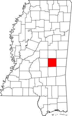
Das Newton County[1] ist ein County im Bundesstaat Mississippi in den Vereinigten Staaten von Amerika. Bei der Volkszählung im Jahr 2010 hatte das County 21.720 Einwohner und eine Bevölkerungsdichte von 14,5 Einwohnern pro Quadratkilometer. Der Verwaltungssitz (County Seat) ist Decatur, benannt nach Stephen Decatur, einem Marine-Offizier und Helden im Britisch-Amerikanischen Krieg von 1812.
Inhaltsverzeichnis
Geografie
Das County liegt etwas östlich des geografischen Zentrums von Mississippi, ist etwa 60 km von Alabama entfernt und hat eine Fläche von 1501 Quadratkilometern, wovon 4 Quadratkilometer Wasserfläche sind. Es grenzt an folgende Countys:
Neshoba County Scott County 
Lauderdale County Jasper County Geschichte
 Isaac Newton
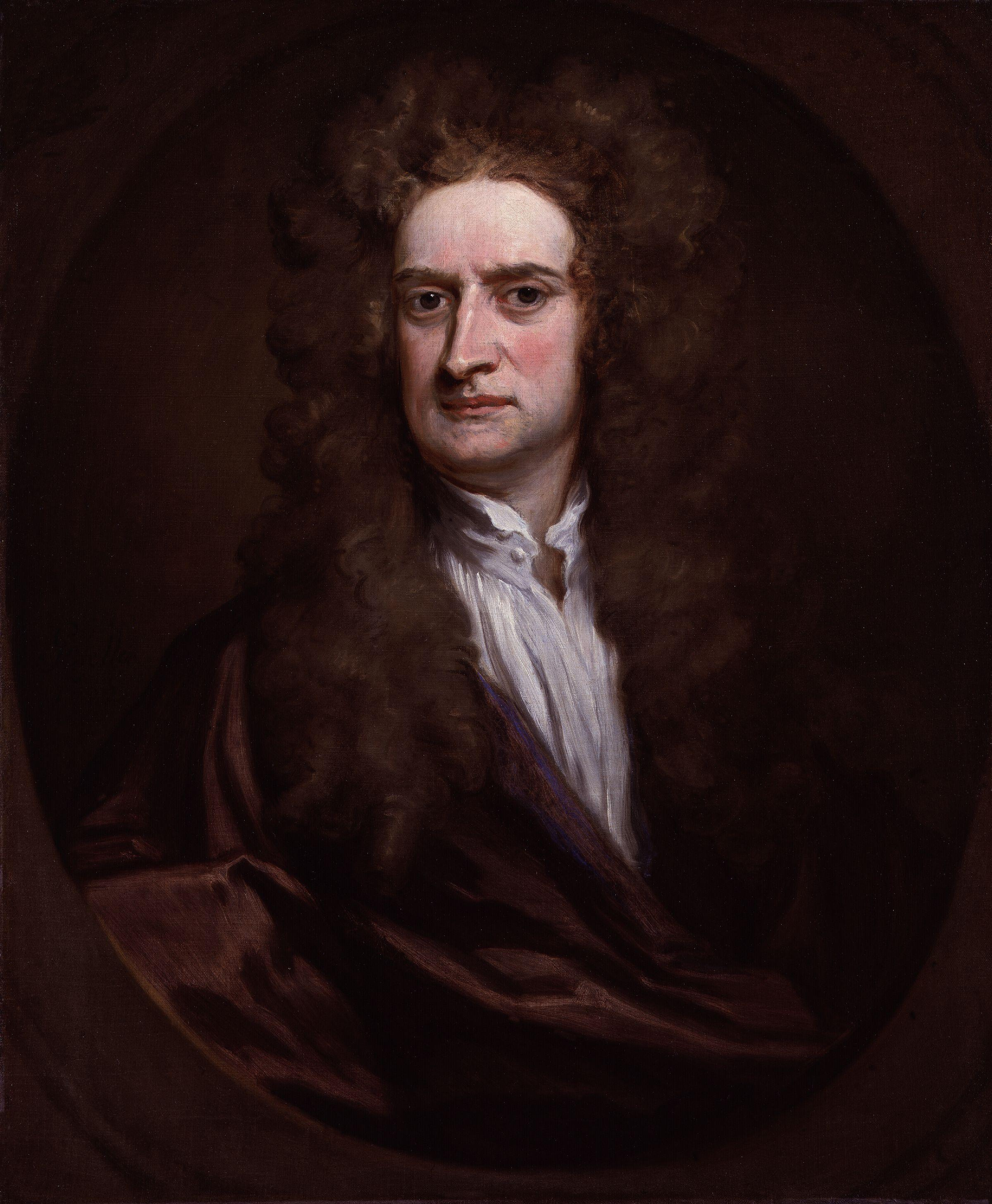
Newton County wurde am 25. Februar 1836 aus Teilen des Neshoba County gebildet. Benannt wurde es nach Isaac Newton, einem englischen Physiker, Mathematiker, Astronom, Alchemist, Philosoph und Theologe.
Demografische Daten
Historische Einwohnerzahlen Census Einwohner ± in % 1840 2527 — 1850 4465 80 % 1860 9661 100 % 1870 10.067 4 % 1880 13.436 30 % 1890 16.625 20 % 1900 19.708 20 % 1910 23.085 20 % 1920 20.727 -10 % 1930 22.910 10 % 1940 24.249 6 % 1950 22.681 -6 % 1960 19.517 -10 % 1970 18.983 -3 % 1980 19.944 5 % 1990 20.291 2 % 2000 21.838 8 % 2010 21.720 -0,5 % Vor 1900[2] 1900–1990[3] 2000[4] 2010[5] Nach der Volkszählung im Jahr 2000 lebten im Newton County 21.838 Menschen in 8.221 Haushalten und 6.001 Familien. Die Bevölkerungsdichte betrug 15 Personen pro Quadratkilometer. Ethnisch betrachtet setzte sich die Bevölkerung zusammen aus 65,01 Prozent Weißen, 30,37 Prozent Afroamerikanern, 3,68 Prozent amerikanischen Ureinwohnern, 0,18 Prozent Asiaten und 0,33 Prozent aus anderen ethnischen Gruppen; 0,44 Prozent stammten von zwei oder mehr Ethnien ab. 0,91 Prozent der Bevölkerung waren spanischer oder lateinamerikanischer Abstammung die verschiedenen der genannten Gruppen angehörten.
Von den 8.221 Haushalten hatten 33,5 Prozent Kinder unter 18 Jahren, die mit ihnen lebten. 53,0 Prozent waren verheiratete, zusammenlebende Paare, 16,0 Prozent waren allein erziehende Mütter und 27,0 Prozent waren keine Familien. 24,6 Prozent aller Haushalte waren Singlehaushalte und in 11,6 Prozent lebten Menschen im Alter von 65 Jahren oder darüber. Die durchschnittliche Haushaltsgröße lag bei 2,57 und die durchschnittliche Familiengröße bei 3,04 Personen.
26,2 Prozent der Bevölkerung war unter 18 Jahre alt, 11,2 Prozent zwischen 18 und 24, 26,0 Prozent zwischen 25 und 44, 21,7 Prozent zwischen 45 und 64 Jahre alt und 14,9 Prozent waren 65 Jahre oder älter. Das Durchschnittsalter betrug 35 Jahre. Auf 100 weibliche kamen statistisch 92,4 männliche Personen und auf 100 Frauen im Alter von 18 Jahren oder darüber kamen 88,7 Männer.
Das durchschnittliche Einkommen eines Haushaltes betrug 28.735 USD, das einer Familie 34.606 USD. Männer hatten ein durchschnittliches Einkommen von 27.820 USD, Frauen 20.757 USD. Das Pro-Kopf-Einkommen lag bei 14.008 USD. Etwa 16,4 Prozent der Familien und 19,9 Prozent der Bevölkerung lebten unterhalb der Armutsgrenze.[6]
Städte und Gemeinden
- Chunky
- Conehatta
- Decatur
- Duffee
- Hickory
- Lake1
- Lawrence
- Little Rock
- Newton
- Union2
1 - teilweise im Scott County
2 - teilweise im Neshoba CountyEinzelnachweise
- ↑ GNIS-ID: 695773. Abgerufen am 22. Februar 2011 (englisch).
- ↑ U.S. Census Bureau _ Census of Population and Housing Abgerufen am 19. Februar 2011
- ↑ Auszug aus Census.gov. Abgerufen am 19. Februar 2011
- ↑ Auszug aus factfinder.census.gov Abgerufen am 18. Februar 2011
- ↑ United States Census 2010 Abgerufen am 14. Juni 2011
- ↑ Newton County, Mississippi Datenblatt mit den Ergebnissen der Volkszählung im Jahre 2000 bei factfinder.census.gov
Weblinks
-
 Commons: Newton County, Mississippi – Sammlung von Bildern, Videos und Audiodateien
 - Fotos des Bezirksgerichts
- History of Newton County
- www.city-data.com

Liste der Countys in Mississippi
Adams | Alcorn | Amite | Attala | Benton | Bolivar | Calhoun | Carroll | Chickasaw | Choctaw | Claiborne | Clarke | Clay | Coahoma | Copiah | Covington | DeSoto | Forrest | Franklin | George | Greene | Grenada | Hancock | Harrison | Hinds | Holmes | Humphreys | Issaquena | Itawamba | Jackson | Jasper | Jefferson | Jefferson Davis | Jones | Kemper | Lafayette | Lamar | Lauderdale | Lawrence | Leake | Lee | Leflore | Lincoln | Lowndes | Madison | Marion | Marshall | Monroe | Montgomery | Neshoba | Newton | Noxubee | Oktibbeha | Panola | Pearl River | Perry | Pike | Pontotoc | Prentiss | Quitman | Rankin | Scott | Sharkey | Simpson | Smith | Stone | Sunflower | Tallahatchie | Tate | Tippah | Tishomingo | Tunica | Union | Walthall | Warren | Washington | Wayne | Webster | Wilkinson | Winston | Yalobusha | Yazoo
Wikimedia Foundation.
Schlagen Sie auch in anderen Wörterbüchern nach:
Newton County, Mississippi — Location in the state of Mississippi … Wikipedia
Newton County — is the name of several counties in the United States: All except for Arkansas and maybe Mississippi are named for Sgt. John Newton. Bold Name indicates county sharing boundary with a Jasper County. Five states have paired their two counties… … Wikipedia
Newton County American Legion Post No. 89 Hut — U.S. National Register of Historic Places … Wikipedia
Newton County School District — The Newton County School District is a public school district based in Decatur, Mississippi (USA). In addition to Decatur, the district also serves the towns of Hickory, Chunky, Little Rock, the community of Conehatta, and the Newton County… … Wikipedia
Newton County — Es gibt in den Vereinigten Staaten sechs Countys mit dem Namen Newton County: Newton County (Arkansas) Newton County (Georgia) Newton County (Indiana) Newton County (Mississippi) Newton County (Missouri) Newton County (Texas) … Deutsch Wikipedia
Newton County, Arkansas — Location in the state of Arkansas … Wikipedia
Newton County, Missouri — Location in the state of Missouri … Wikipedia
Newton County, Indiana — Location in the state of Indiana … Wikipedia
Newton County Courthouse (Indiana) — Newton County Courthouse U.S. National Register of Historic Places … Wikipedia
Newton County (Arkansas) — Verwaltung US Bundesstaat: Arkansas Verwaltungssitz: Jasper Adresse des Verwaltungssitzes: County Courthouse P.O. Box 435 Court Street Jasper, AR 72641 0435 Gründung: 14. Dezember 1842 … Deutsch Wikipedia
Newton County (Mississippi)


18+
© Academic, 2000-2024
- Kontaktieren Sie uns: Unterstützung, Werbung
Wörterbücher Export, schritte mit PHP, Joomla, Drupal, WordPress, MODx.